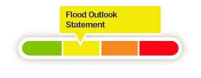
Quinte Conservation has issued a Flood Outlook Statement for inland lakes and watercourses in advance of the weather system forecasted to pass through the Quinte watershed this weekend.
The current forecast anticipated 20-40 mm of mostly freezing rain with a possibility of rain and snow.
The temperature is expected to hover around the freezing mark for most of the weekend with temperatures beginning to rise Sunday afternoon and highs exceeding 10 degrees Celsius early in the week.
While watercourses and lakes have peaked from the initial spring snowmelt and remain elevated, it is anticipated they will rise further due to the weekend precipitation.
Quinte Conservation notes the seasonal spring peak for the region was well below the average but that watershed soil remains saturated with reduced ability to absorb rainfall.
With the upcoming precipitation, the rate at which water levels are expected to rise will be faster than the previous peak due to wet ground conditions and existing high flows.
Water levels could also increase further late next week with the possibility of more rain next Thursday and Friday.
Due to the high level of uncertainty with the long-term weather prediction, flood forecasting staff will closely monitor the situation and will update flood messaging if conditions warrant.
Risks: Localized flooding is possible in flood-prone and low-lying areas. All ice-covered water should be considered unsafe.
Actions: Residents in flood-prone or low-lying areas should closely watch water levels and take necessary precautions to protect their property. Ensure sump pumps are in good working condition and that there is access to a portable back-up generator and pump. Reduce ponding by keeping ditches, culverts, and storm drains clear from obstructions.


